Area Attractions & Recreation
If you are seeking to explore Del Norte and the surrounding area, we recommend visiting these resources to help plan your path.
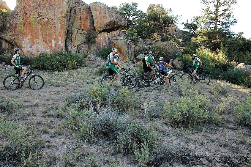
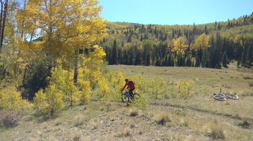
Bishop Rock Area – BLM
Elevation: 8,280 ft.
Difficulty: Intermediate to Difficult
Distance: 40 acres of open play area
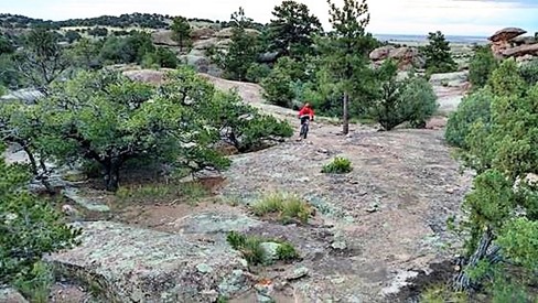
Open most of the year. In Monte Vista, at the corner of US Highway 160 and Colorado State Highway 15, turn south and drive for 2.5 miles to Rio Grande County Road 28; then turn west and drive for 7.7 miles; turn right into the Bishop Rock Parking area; off-load and ride the two-track to the “domed rock area.” The BLM’s Bishop Rock Area is unmatched anywhere in the State of Colorado. It contains a 40-acre slick-rock non-motorized open play area for bikers and hikers. For advanced riders, this freeform area of flowing rocks creates something similar to a natural skate park. This playground, designated as such by the BLM, has all the features you could ever want to test your skill level. Map available at www.delnortetrails.org
Creede Repertory Theater
The CRT Main Stage started life in the 1930s as a movie house. Later it became The Creede Opera House, where owner, Carl Helfin, started melodramas. It was shuttered for a few years before its rebirth as Creede Repertory Theater in 1966. CRT is a professional, award-winning theatre company located at 9,000 feet in the San Juan Mountains producing big city quality productions from May through September. Each season CRT produces 7-10 plays in rotating repertory, hosts numerous musical events and concerts, develops new works through the Headwaters New Play Program, and offers nationally recognized educational programming. “USA TODAY called us “one of the 10 best places to see the lights way off Broadway” and THE DENVER POST hailed CRT as “legendary” and “one of the state’s top five theatre companies.” http://www.creederep.org/
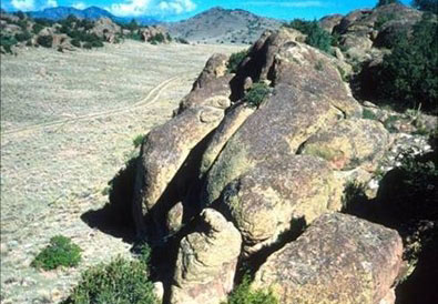
Elephant Rocks
From the intersection of US 160 and CO 112 in the center of Del Norte, head north on CO 112 for three miles; turn left (north) on Rio Grande CR 33. The Elephant Rocks begin within less than a mile on the west side of the road. Elephant Rocks are a weathered remnant of the Fish Canyon tuff, dating from the late Oligocene period roughly 28 million years ago. This is a five-mile long formation of monolithic boulders within a mix of short grass prairie and foothill shrub land. This area is full of amazing scenery and is great for exploring. You might see Rock Wrens, Green-tailed Towhees, Ash-throated Flycatchers, Bushtits and Pinyon Jays, Cassin’s Kingbirds, pronghorn, deer, marmots, lizards, snakes, chipmunks, and rock squirrels.
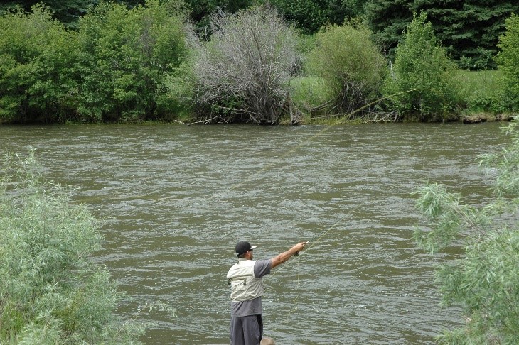
Fish the Upper Rio Grande
The Upper Rio Grande area offers some of the best fishing in Colorado. Gold Medal waters on the river and an abundance of creeks, lakes, and reservoirs provide year-round opportunities for the avid fisherman! Brown and rainbow trout fishing is good from the Rio Grande Reservoir downstream to Del Norte. The section of water between South Fork and Del Norte on the Rio Grande provides the best location for catching trophy brown trout. Online and in-person, check with knowledgeable outdoor shops, license vendors, fishing lodges, guides and outfitters. https://www.southfork.org/fish
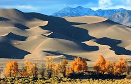
Great Sand Dunes National Park & Preserve
Open all day and night year-round, the tallest dunes in North America are the centerpiece in a diverse landscape of grasslands, wetlands, conifer and aspen forests, alpine lakes, and tundra. Experience starry sky on moonless nights, or a surreal walk on the dunes under bright full moonlight. The Great Sand Dunes is designated an “International Dark Sky Park.” http://www.nps.gov/grsa/index.htm
Limekiln Area – BLM connecting to USFS
Elevation: 7,900
Difficulty: Easy to Intermediate
Distance: 9.3 miles of single-track; 24.1 miles of motorized single-track; 29.2 miles of open roads
Open most of the year. Start 6 miles east of Del Norte on US Hwy 160 at the Limekiln /Old Spanish Trail monument. This 13,783-acre area is a large expanse of land with purpose-built, NEPA approved single-track on almost every geographic feature, and connected by two-track roads. It easily provides over 100 miles of riding.
Lookout Mountain Park Trails – Town of Del Norte
Elevation: 7,884 to 8,475 ft.
Difficulty: Easy to Intermediate
Distance: 8 miles
Open all year, this USGS named summit at 8,475 feet sits within the Town of Del Norte’s 200-acre park. Eight miles of natural surface, single track trails provide diverse experiences to hikers, runners, bicyclists, and equestrians. The more difficult one-mile trail to the summit has an elevation gain of 600 feet with wonderful craggy switchbacks near the top. Known to locals as “D” Mountain, its breathtaking summit view displays the entire San Luis Valley and the upper Rio Grande corridor. The land and trails system connect the town to the High School on the east, to BLM land on the south, to Rio Grande Hospital and Clinic on the west and US Hwy 160 on the north. Map available at www.delnortetrails.org
Middle Frisco Trail #879
Elevation: 9,000 to 11,982 ft.
Difficulty: Intermediate to Difficult
Distance: 6.3 miles one way
Open seasonally, weather permitting. From the Town of Del Norte on US Hwy 160 turn south on French Street (Rio Grande County Rd 13) for 10 miles until you dead end at the first parking lot just as you cross the cattle guard. A classic out-and-back alpine mountain bike ride or hike climbs nearly 3,000 feet and ends at Frisco Lake, which is a cirque below Bennet Peak (elevation 13,203). The trail follows Middle San Francisco Creek through beautiful aspen groves for the first few miles. It then climbs through a mix of open meadows and spruce/fir forest, with 10 switchbacks on the upper section of the trail that are rideable with a nice grade. Once you arrive at Frisco Lake, take some relaxing time before returning on the same trail. Watch out for hikers and horses on the way down. It is a great ride for intermediate and advanced riders. Map available at www.delnortetrails.org
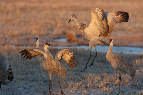
Monte Vista Crane Festival
Late in February, Sandhill Cranes, the San Luis Valley’s oldest visitors, begin their annual trek from south to north, stopping off at the Monte Vista National Wildlife Refuge to load up on fuel. Approximately 23,000 – 27,000 Sandhill Cranes migrate biannually (peak Mid-March and Mid-October) through the San Luis Valley. In Colorado’s Valley of the Cranes wildlife watchers are drawn to wonder at this phenomenal natural spectacle. The annual Monte Vista Crane Festival in March hosts wildlife experts, local naturalists and biologists, guided bus tours, films, sunset trip to view the cranes and visits to closed areas of the refuge. For more information, visit: https://mvcranefest.org/
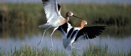
Monte Vista National Wildlife Refuge
With 14,804 acres of waterfowl habitat wetlands, the refuge is a place for wildlife, a wide variety of waterfowl and other water birds. Mallards, pintails, teal, and Canada geese are common, as are American avocets, killdeer, white-faced ibis, egrets, and herons. Irrigation canals and wells provide precious water to maintain this important habitat. In spring and autumn thousands of Sandhill Cranes stop off at the Refuge to load up on fuel in their biannual migration. https://www.fws.gov/refuge/monte-vista
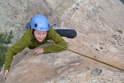
Narrow Ridge Outdoors
Remarkable adventure experiences that enrich lives and encourage stewardship of the natural environment. Narrow Ridge, LLC is an outdoor recreation guiding company based in South Fork and serving the greater San Luis Valley. Owned and managed by Curt Howell, it was established in 2021. Howell is a professional outdoor educator and guide with twenty years of experience in outdoor recreation. Narrow Ridge provides guided rafting trips on the Upper Rio Grande, rock climbing, hiking, and instructional courses. https://www.narrowridgeoutdoors.com/
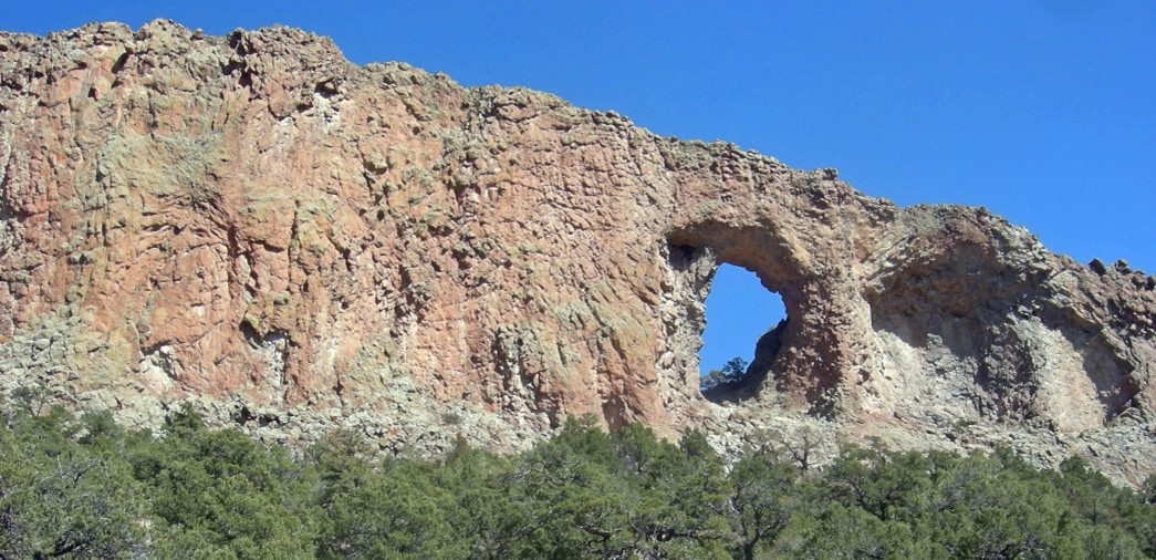
Natural Arch
Natural Arch was formed by the action of wind, rain and weather on a volcanic dome. Although it has some attributes of a shelter natural arch, the oval shape of its opening and the shapes of adjacent depressions in the volcanic dike indicate that it formed as a fin natural arch. From the intersection of US 160 and CO 112 in the center of Del Norte, head north on CO 112 for three miles; turn left (north) on Rio Grande CR 33, which becomes CR 38A; follow for 6+ miles; take a left on Forest Rd 660; travel about 4 miles to Forest Rd 659; take a right and Natural Arch is just over a mile on your right.
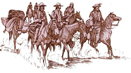
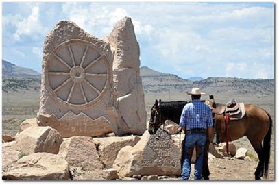
“Old Spanish Trail” Association, La Vereda Del Norte Chapter
One of America’s longest, most scenic historic trails takes you to visit native Americans, Mexican gentlemen, and colorful trappers. Watch for Churro sheep and big pack mules along the way. Treks through Colorado on the Old Spanish National Historic Trail offers diverse scenery, significant history, and tale of connecting New Mexico to southern California (in a car, on bike, or on foot). Travelers (1829-1848) packed mules with woolen goods to Los Angeles. They returned to Santa Fe with horses and mules for trade to Missourians. Many returned to southern California, leading growth and change of the agrarian Los Angeles basin. Their long trips through scenic mountain terrain followed ancient Ute pathways. Today’s mostly paved or gravel roads take you to scenic views of high mountains, deep canyons, cultures and ranches, forests, parks, and deserts. Personal adventure – no cost. See oldspanishtrail.org for map, books, photos. www.oldspanishtrail.org
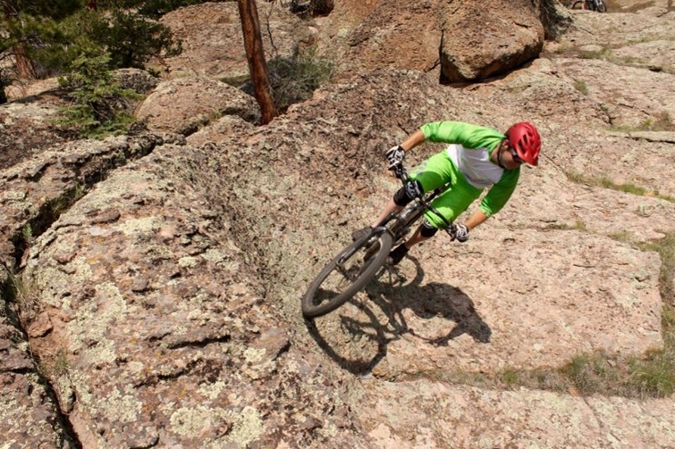
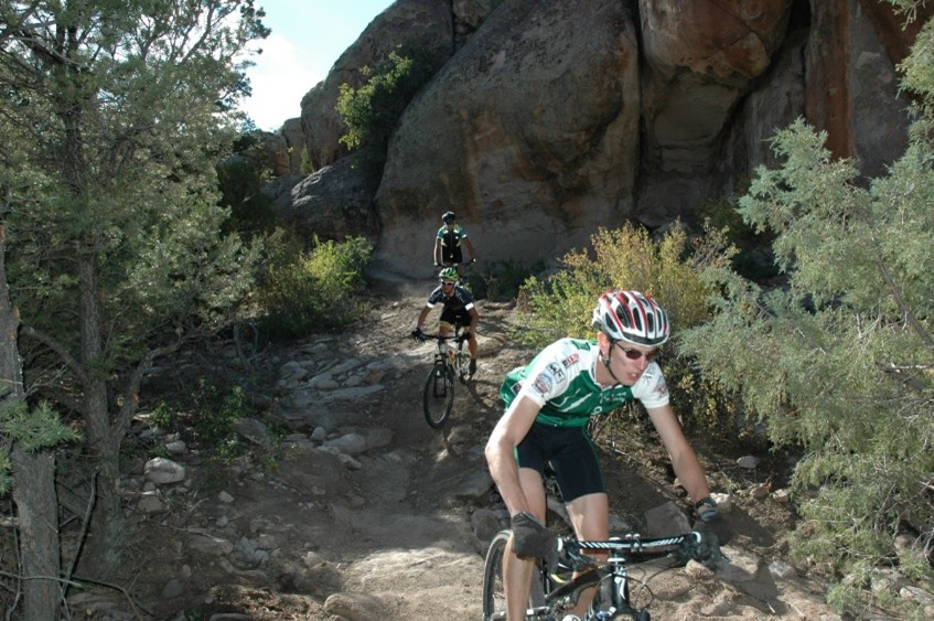
Penitente Canyon Recreation Area – BLM
Elevation: above 8,000 ft.
Difficulty: Easy to Difficult
Distance: 20+ miles
Open most of the year and located 15 miles north of Del Norte off of Hwy 112 on to County Rd 33, continuing as Saguache County Rd 38A for about 12 miles to the signed entry. This is a high desert canyon and low alpine riding/hiking trail system. It comprises purpose-built NEPA approved, non-motorized, single-track trails, as well as technical rock climbing, campsites, and horse trails. It is home to the “12 Hours of Penitence” endurance mountain bike race each autumn. While in the area, you’ll ride through some of the country’s most fascinating history and geology. This is part of the La Garita Caldera, 22 miles wide and 47 miles long. Map available at www.delnortetrails.org
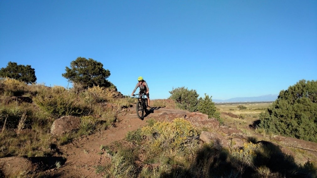
Pronghorn Trails System – BLM
Elevation: 7,900 to 8,600 ft.
Difficulty: Easy to Difficult
Distance: 9.5 miles
Open May 1 to Dec. 31. In Del Norte on US Hwy 160 turn south on French Street (Rio Grande County Rd 13) for 1 ½ miles. For hikers and mountain bikers, this single-track non-motorized natural surface trail connects to Del Norte’s Lookout Mountain Park and Trails. These NEPA approved trails have long, mostly gradual climbs and descents. The area has a mix of rock features, canyon, and big vistas of San Francisco Creek, the San Luis Valley and the Sangre de Cristo Mountain range. Centering around one large loop, the climbs/descents are longer than many in the area with some excellent lower watershed features. Mule deer, elk, falcons, hawks, and other bird species, desert flowers, grasses and reptiles inhabit the area. Map available at www.delnortetrails.org

Rhythms on the Rio
Benefit music festival on the historic Rio Grande held in early-August in Del Norte. The annual event is hosted by the South Fork Music Association. SFMA is a volunteer and non-profit organization that provides musical instruments and lessons, free of charge, to children throughout the San Luis Valley. KEEPING MUSIC ALIVE – ONE CHILD AT A TIME http://rhythmsontherio.com/
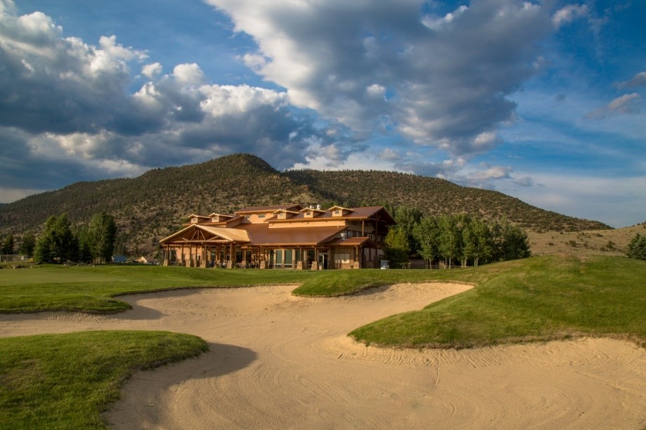
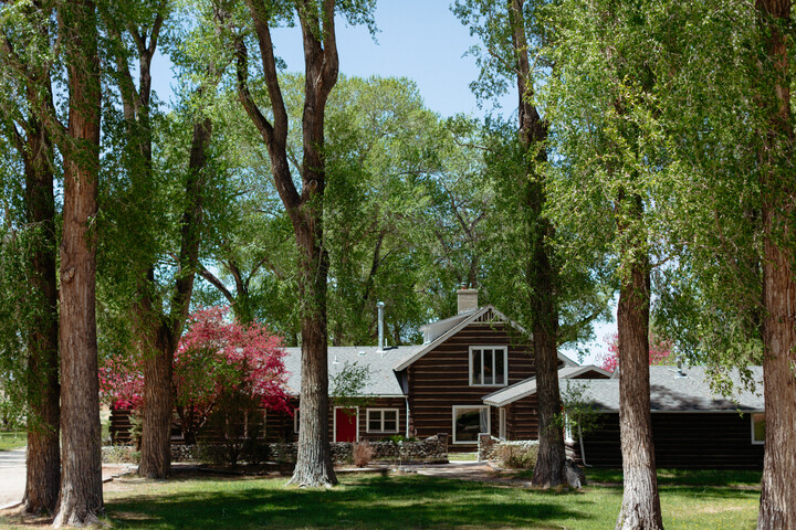
Rio Grande Club & Resort
Located adjacent to the Rio Grande National Forest and nestled in South Fork, Colorado near Wolf Creek Ski area, the Rio Grande Club & Resort is a semi-private club with golf play and two restaurants open to the public. This 18-hole award-winning golf course offers 9 holes that meander alongside the Rio Grande River and 9 holes with glorious alpine terrain and spectacular mountain views. The club offers amenities and facilities through three membership plans.
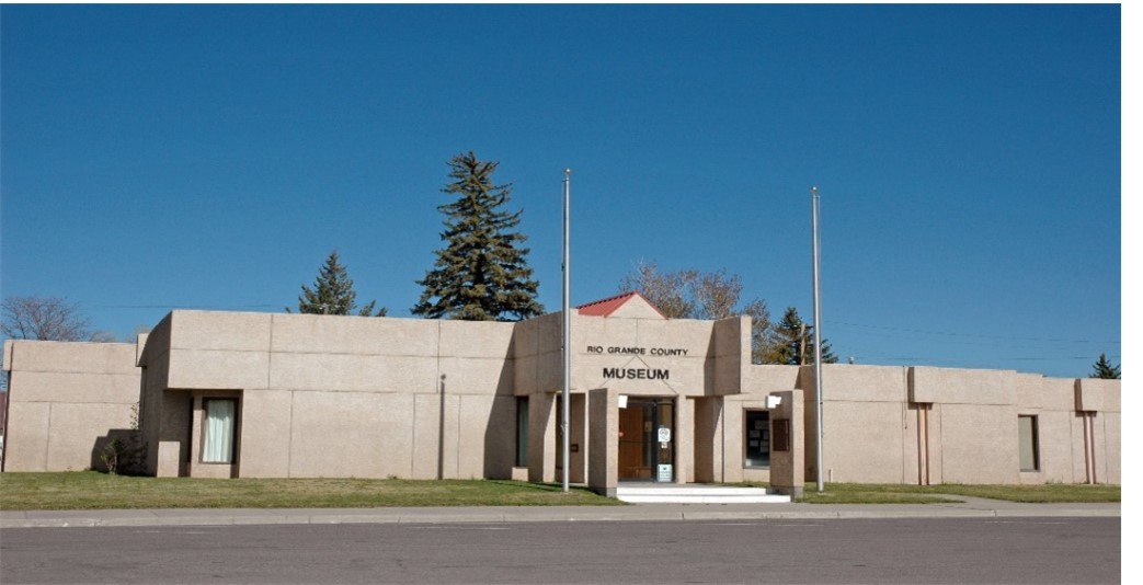
Rio Grande County Museum and Cultural Center
Rio Grande County Museum offers a pathway into the history and culture of the area. The Native Americans, the mountain men and trappers, the settlers from New Mexico with the Mexican land grants, gold seekers, farmers, ranchers, cowboys, merchants and those who came for the adventure are represented in exhibits. The stories of John C. Fremont and the Fourth Expedition and Col. Pfeiffer, captain in the Army with Kit Carson, are told. The history of Rio Grande County can be experienced with walking tours through the towns of Del Norte and Monte Vista starting with a visit to the Museum. Summertime brings seasonal art shows of local artists with a variety of art styles shown. The Museum also serves as an information center for the Del Norte area where maps, brochures and tourist information are available. Summer hours are Tuesday through Friday from 10:00 to 4:00 and Saturday 10:00 to 3:00. 580 Oak Street Del Norte, CO 81132 • (719)657-2847 • http://www.museumtrail.org/rio-grande-county-museum.html

Silver Thread Scenic Byway
Links Creede, Lake City, and South Fork via Hwy 149. Also designated as a U.S. Forest Service National Byway, the Silver Thread alludes to the rich veins of silver ore that lured miners and settlers. It weaves along spectacular river canyons and climbs over the Continental Divide via Spring Creek Pass, and the heights around Creede and Lake City remain strewn with abandoned mining structures. https://www.southfork.org/silver-thread-scenic-byway
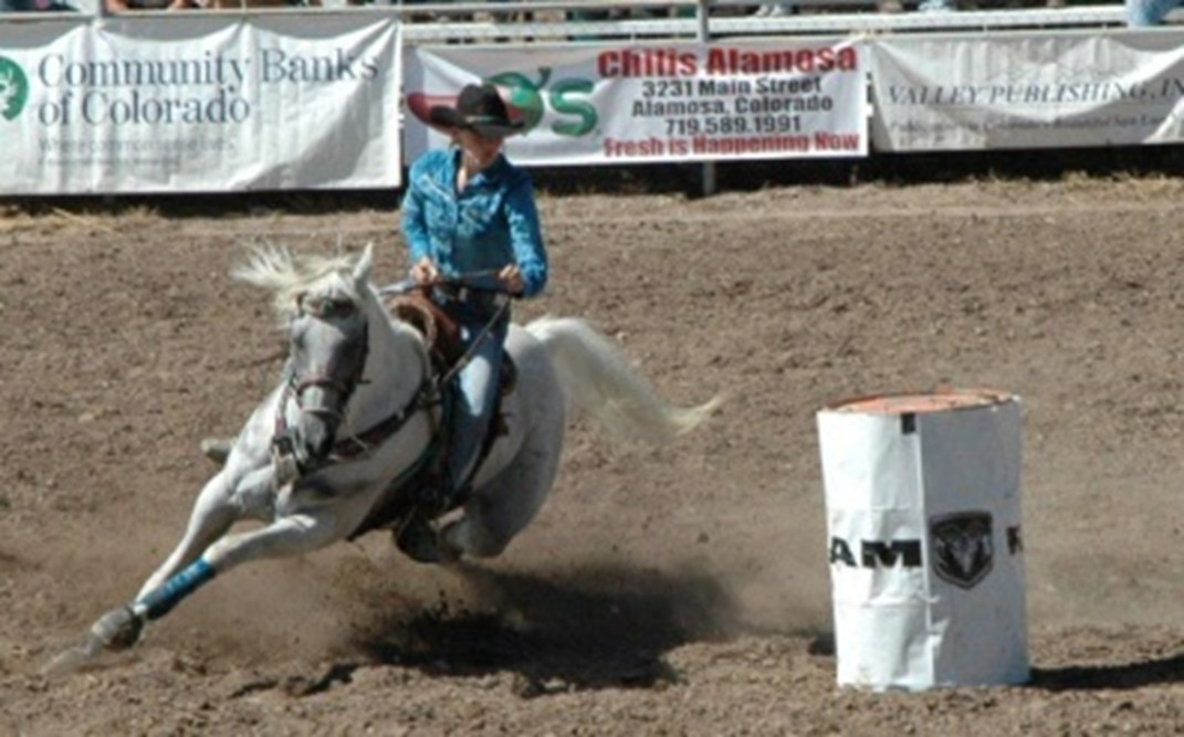
Ski-Hi Stampede
The Ski-Hi Stampede, Colorado’s oldest pro rodeo, has roots as deep as the San Luis Valley itself. The first rodeo was held August 11-13, 1919, in Monte Vista and was called Ski-Hi Stampede. Old newspapers reported that more than 10,000 people assembled to watch the local competition. It has continued for nine decades as an annual event and is an important piece of western history that can still be lived. http://www.skihistampede.com/
Stone Quarry Trail System – BLM
Elevation: 7,900 to 8,200 ft.
Difficulty: Intermediate to Difficult
Distance: 9.5+ miles
Open most of the year. This is a venue for mountain bikers and hikers alike located off of US Hwy 160, 5 miles east of Del Norte, then south on Gun Club Road. This geologic area is a unique, rugged region with large boulder formations, which give the user a sense of seclusion. The high desert canyons provide a technically challenging play area with tight, winding, purpose-built, natural surface and slickrock single-track trails (NEPA approved non-motorized). Several times the trail surfaces from the rock canyons, providing panoramic views of the San Luis Valley and surrounding mountain ranges. Map available at www.delnortetrails.org
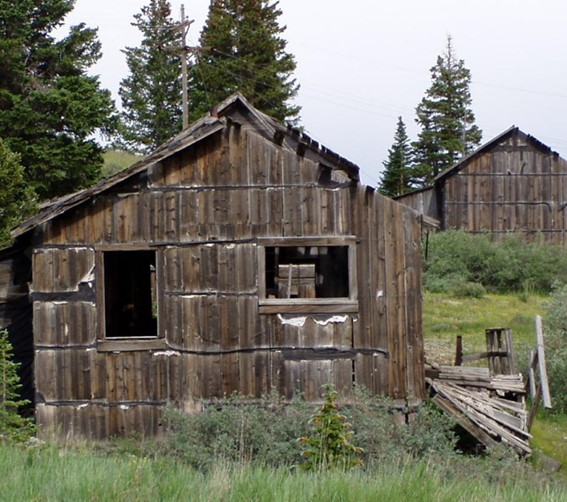
Summitville Gold Mines
Located 11,000ft above sea level, Summitville has had a rough 100-year history, which has given forth more than 7.5 million dollars, worth of gold, silver, lead, and copper. During its hay day, this town and mine had six processing mills, stores, saloons, boarding houses, homes, a school and slaughter house. However, today the site is home to a multi-million-dollar mining cleanup; resulting from high levels of cyanide and arsenic in the soil, which was once used to extract the gold. Due to health dangers there is no direct access to the mining site, but visitors can still see the remnants of the mine and experience the historic town buildings. 25 miles south of Del Norte, CO on County Road 14.
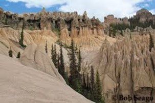
Wheeler Geologic Area
Wheeler Geologic Area is part of the La Garita Wilderness, 640 acres of haunting landscape, remarkable geologic formations, and expansive views; the area was designated a National Monument from 1908 until 1950 and was Colorado’s first National Monument. Located near the old mining town of Creede, it is accessible by a 7-mile hike or a difficult 14-mile four-wheel drive road. https://www.fs.usda.gov/recarea/riogrande/recarea/?recid=29264
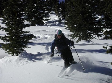
Wolf Creek Ski Area
Wolf Creek Ski Area is in the San Juan Mountains, a world-class powder destination where knee-deep days are not unusual. It has the most snow in Colorado with average snowfalls of 400 inches per year creating a base of 12 feet or more. Wolf Creek has 750 acres of well-maintained slopes with 20% beginner, 30% intermediate, 25% advanced, and 20% expert. Base altitude starts at 10,350 feet. Modern lifts carry skiers to the Continental Divide at 11,775 feet. http://www.wolfcreekski.com/
Zapata Ranch
The Nature Conservancy Preserve is a 103,000-acre working bison, cattle, horse, and guest ranch. It borders on the Great Sand Dunes National Park & Preserve. The high desert grasslands, alpine forests, wetlands, sand dunes, creeks, and lush meadows offer one of the most scenic and ecologically diverse landscapes in the United States. http://www.zranch.org/